CAD data is essential in order to integrate into GIS and convert to other file formats such as geodatabase feature layers. The data is drawn to scale lacking an assigned coordination system therefore georeferencing is needed to coordinate the data appropriately. Both CAD and GIS information are used for spatial analysis and to reveal data distribution patterns and trends. Because of this, it is important to know how to overlap, analyze and work between the two. CAD data must first be georeferenced involving carefully identifying reference points within the data using imagery such as orthophotos, tiles and other files and formats. Once correctly georeferenced the data is saved storing spatial information and the specific georeferenced location identified by the user. ArcGIS offers users various tools to export CAD data including exporting entire datasets as feature datasets. For the example below the georeferencing toolbar from ArcToolbox was an integral tool used to georeference a master file to an orthophoto image. Next, ArcToolbox tools such as Feature Class to Feature Class and Feature to Polygon were used to create shapefile and feature layers that ultimately created a feature class that included all necessary buildings for the map display.
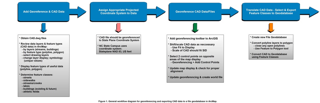
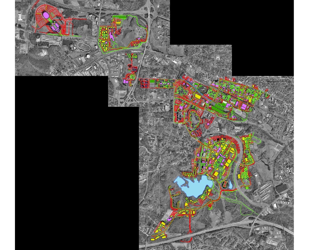
Figure 2. CAD data of the NCSU campus after georeferencing to the reference aerial orthophoto (color scheme altered for visibility). Note that the CAD features are aligned with the features in the photo.
