US Census data is freely available to the public and is used to create thematic maps for any area in the county. US Census tabular data from the Social Explorer site is selected by choosing the necessary dataset (i.e. 2010 census), a geographic area (i.e. N.C., Wake County, Raleigh), and topic of interest (i.e. average age, population, education, income, race). Once selected and downloaded, the corresponding Tiger/Line® shapefile geography data was obtained from ESRI/ArcGIS. The tabular data must be edited so that the headings/fields are unique and descriptive so that the unique ID (i.e. census tract number) matches the formatting found in the corresponding field in the shapefile. After the tabular data has been edited, it can be joined in ArcMap to the shapefile using the unique ID chosen.
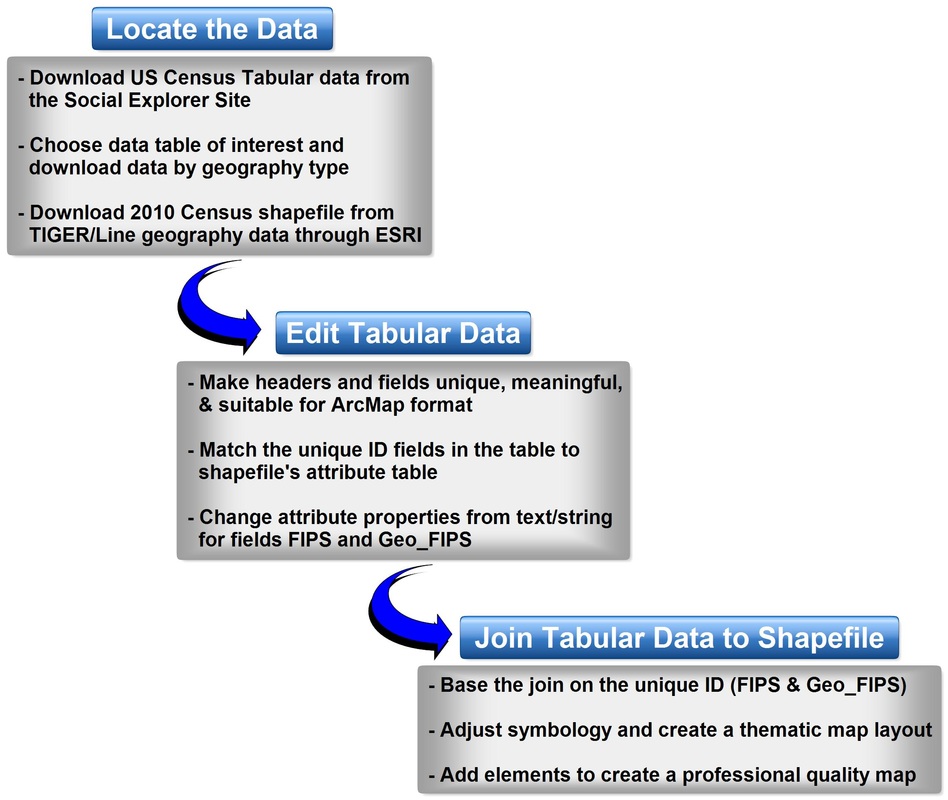
General workflow diagram for obtaining and joining US Census data to create a thematic map in ArcMap.
Census data contains economic and demographic data for multiple levels of geography across the United States. Understanding how to locate Census Data is a vital tool used in GIS. This study analyzes the various age groups of the female population in the Wake County, N.C. area. The Census 2010 data table used for this analysis is titled "T16", Age for Population including variables T016_001 (Female Population), T016_002 (Under 18 years), T016_003 (18 and 34 years), T016-004 (35-64 years) and T016_005 (65 and over).
Table & Attribute Utilized:
Table & Attribute Utilized:
- R10568108_SL140: T16. Age for Female Population
- US Census Tabular Data: N.C. and Wake County Tracts (.shp)
- Attribute & Field Name: T016_003: 18 and 34 years of age
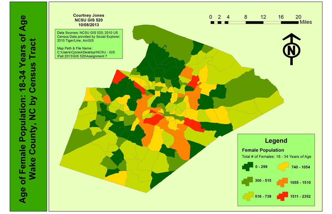
Total number of females, 18-34 years of age in Wake County, NC by census tract provided by the 2010 census. Click on map for enlarged image.
This study showed how to download and display age and population data for census tracts in Wake County, N.C. As with most maps, the geography scale and Census variables may greatly affect or skew your results; however, given the relatively smaller size of Wake County’s geography the Census variable patterns were apparent and effective.The skills and concepts from this analysis could be used in a wide variety of GIS applications.
As for other agencies, these tools could be used to assist in the planning of projects at a college or university, museum, neighborhood, school, etc. Census data would also be an important tool when assisting with town, city or urban planning. Town/city hall members and planners have a variety of use for the demographic, economic and social data that the U.S. Census provides.
As for other agencies, these tools could be used to assist in the planning of projects at a college or university, museum, neighborhood, school, etc. Census data would also be an important tool when assisting with town, city or urban planning. Town/city hall members and planners have a variety of use for the demographic, economic and social data that the U.S. Census provides.
