|
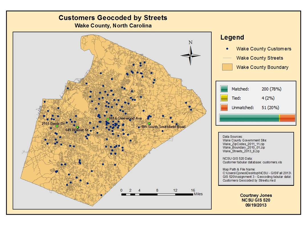
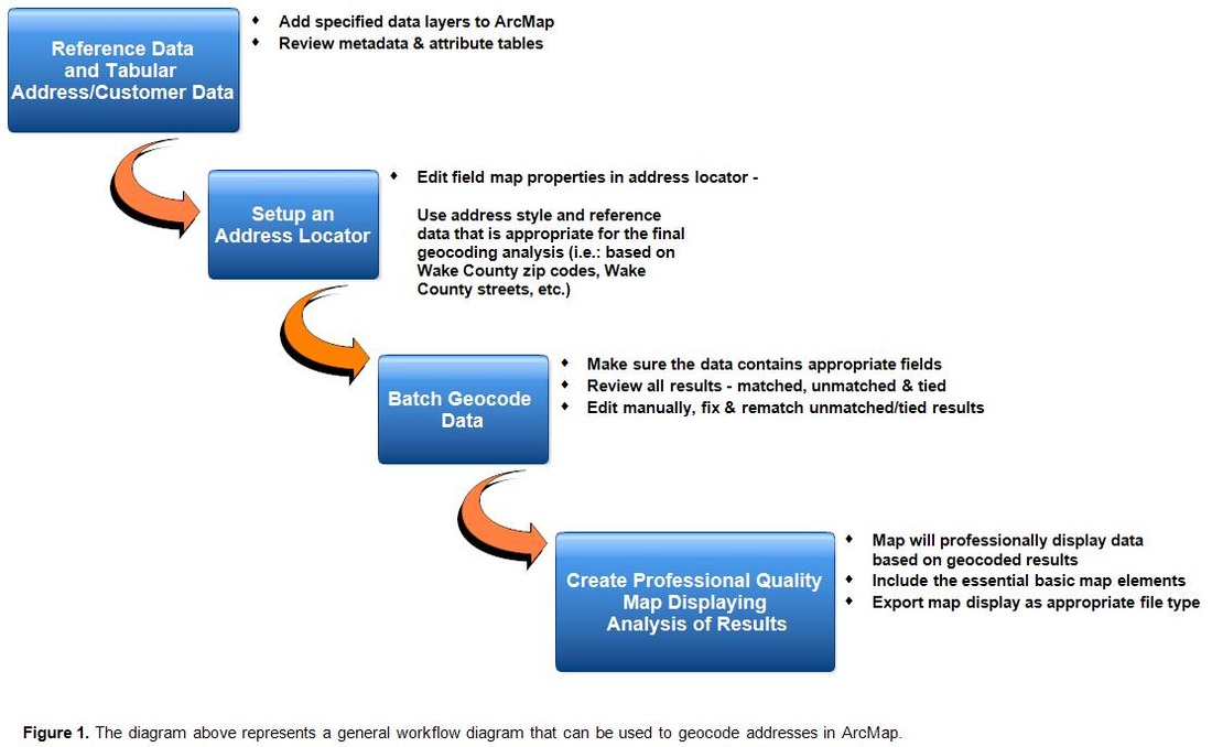
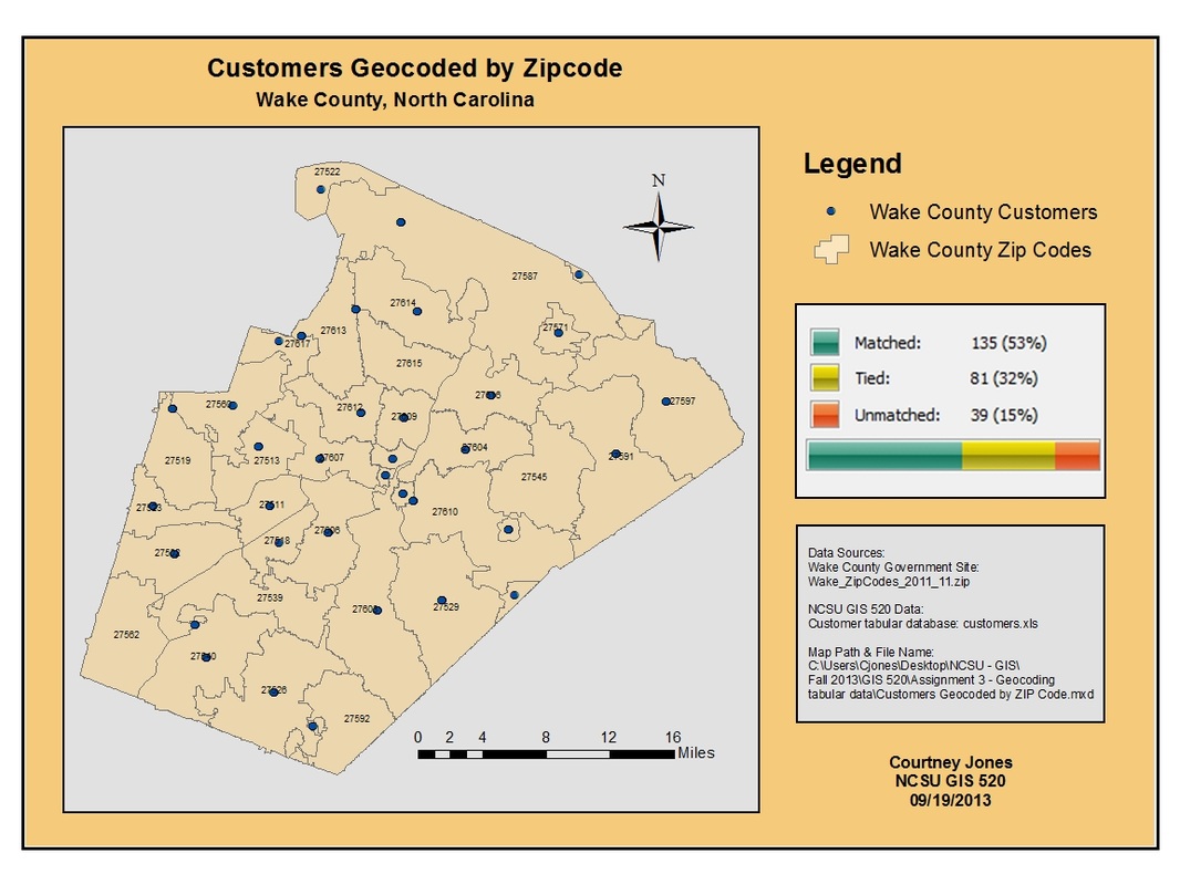
Often GIS clients will provide tabular address information, this data must be geocoded. ESRI ArcGIS software including both ArcMap and ArcCatalog can be used to create custom geolocators to complete this process. An address locator is created and defined by the locator style and reference data used. In this case study, a commercial establishment provided a tabular database of their customers address information from their last month of sales while street, county boundary, and zip code information was available through the Wake County government website. Using ArcMap and various Geocoding Tools, the locations of the customers were spatially represented using two methods, first by zip code location and then according to their individual street addresses. Following analysis, the data was used to determine which method created a better visualization for the efforts of commercial market research. ArcMap can geocode the attendees addresses to spatial locations on a map interface. After reviewing the metadata and attribute tables to ensure the appropriateness of the data, address locators were set up. Depending on how the data were to be geocoded (i.e. zip code, street address, etc.), the correct address locator type and reference data was selected. After activating the address locator, the attendee's data was batch geocoded according to the address locator with the respective address fields within the tabular data. The geocoded process results in each record being matched, unmatched, or tied and the user has the option of reviewing and re-matching the address data manually. The results can then be displayed in a map layout to visually depict spatial patterns and address distribution.
|
GIS geocoding tools are generally associated with tasks such as marketing, sales, predictive analysis, businesses, zoning, etc. These skills and concepts are crucial in these specific sectors in order to thoroughly create relevant spatial data that is useful and assists in understanding potential clients, customers, opportunities, threats and to gain a better understanding of geospatial distribution and trends.
|
