Background
The NC National Guard is a proven leader in the combat against illicit drug production in NC, specifically locating marijuana plants and plots. Guard aviation units and Counter Drug teams assist in a statewide effort with state, local and federal law enforcement personnel in providing aerial searches and intelligence for probable marijuana grow sites. In order to combat and recognize emerging tactics and trends, alternative efforts driven by the use of proactive intelligence are being evaluated including changes in land cover between growing seasons, satellite imagery and GIS mapping. The NCNG and NCSBI have worked together to create maps that identify marijuana site hot spots; however, a mapping application has not been previously created and used.
Problem
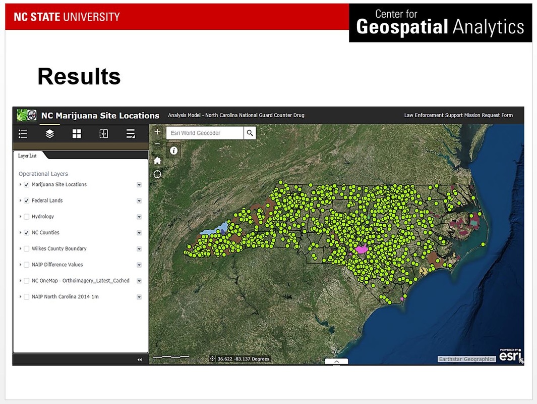
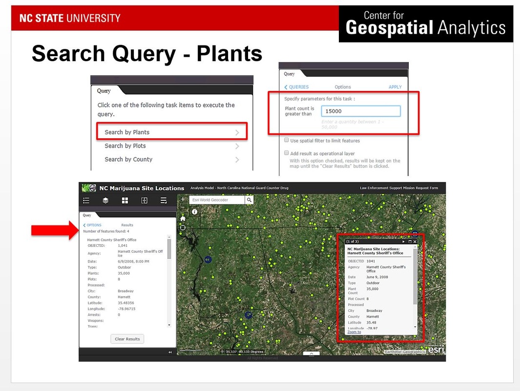
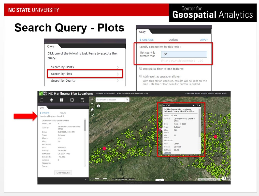
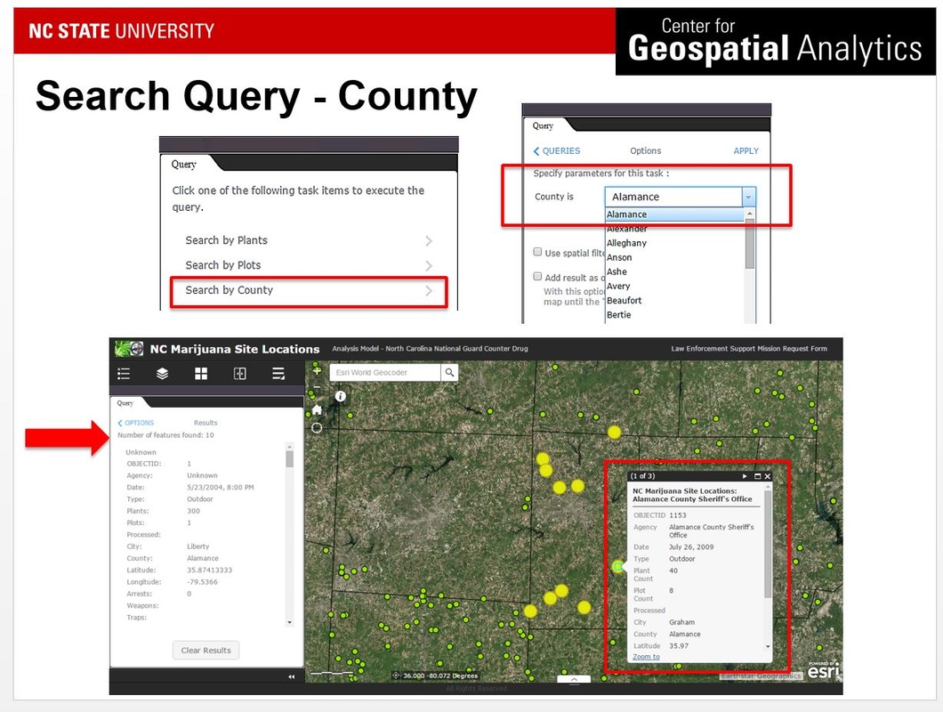
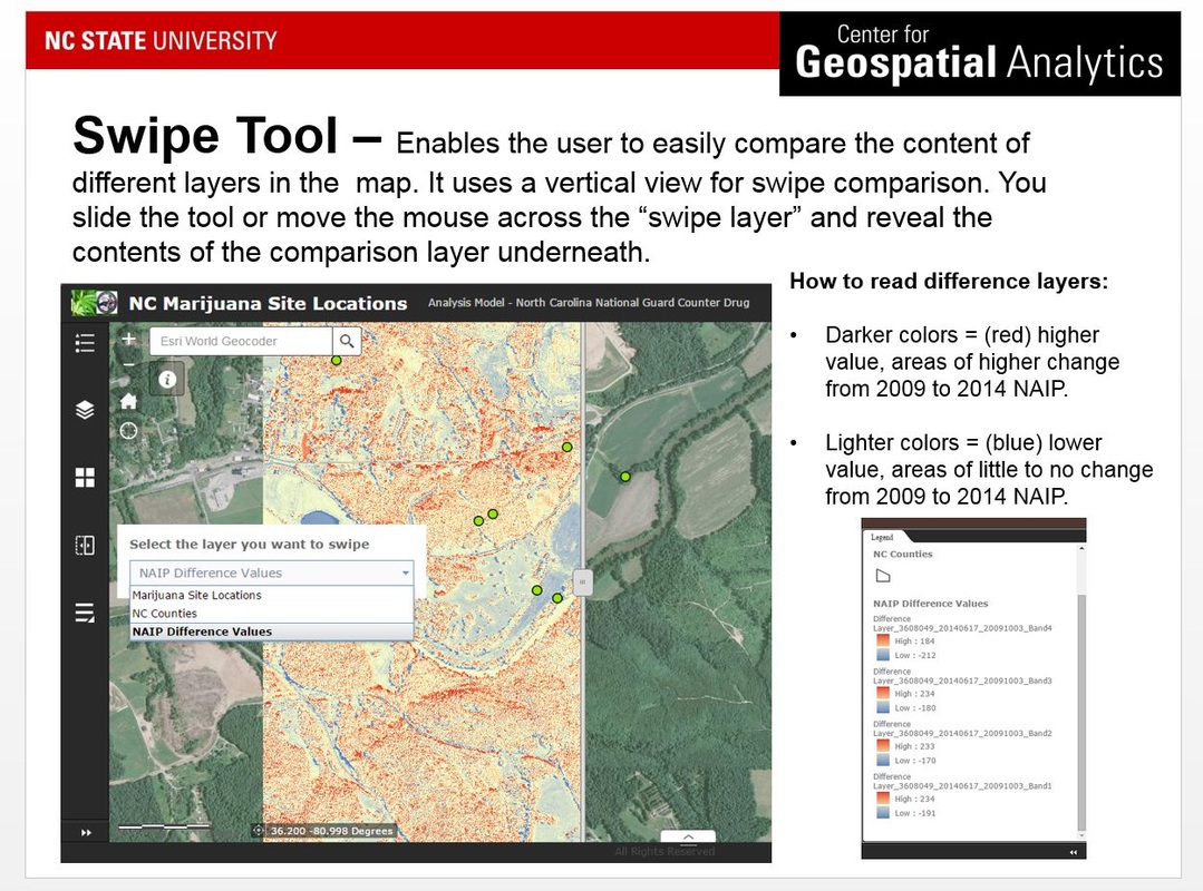
A web mapping application using spatial analyst and imagery was created in an effort to assist in the location of probable marijuana plots based on plant reflectance values and spatial geometry of known historical sites. NCSBI data was incorporated to view, search, query and compare marijuana site locations. NAIP 2009 and 2004 imagery (as well as NCOne Map) was added to perform image analysis to evaluate the success of change detection in an effort to identify the probability and suitability of the locations of marijuana plots. The final web mapping application provided an interactive query of plots, plants and user defined counties as well as a GIS and remote sensing approach for image analysis and change detection through the use of visual detection and WebApp Builder for ArcGIS Online's Swipe Tool.
A web mapping application was created that was adaptable and versatile enough to be used by both the NCNG and NCSBI catering specifically to the individual needs and interests of counter drug aviation teams, pilots, ground teams, drug agents and the intelligence community.
A web mapping application was created that was adaptable and versatile enough to be used by both the NCNG and NCSBI catering specifically to the individual needs and interests of counter drug aviation teams, pilots, ground teams, drug agents and the intelligence community.
Results and Tools
Click on an image below to learn more about the final application capabilities
Reflection
The mapping application serves as a tool for the NCNG Counter Drug Unit used for accurately predicting probable marijuana plot site locations. By using the application to proactively locate plot locations, the NCNG can maximize their resources available (i.e.: man power, ground teams, hours, flight teams, fuel costs, etc.) and serves as a proactive intelligence resource. The application is able to provide maps prior to missions based on user inputs and desired results and assists in appropriately allocating flight hours and fuel costs. Ultimately, I hope to introduce the importance of web application/GIS integration to both law enforcement and military fields/agencies.
Ultimately, the application can be used as a base for NC for the NCNG Counter Drug team. Other drugs or areas of research could be incorporated in the future. Imagery options can be evaluated further and used for a more in depth analysis determining if a comparison of known marijuana site locations with aerial satellite imagery returns accurate predictions for probable marijuana site locations. Project continuation and updates are contingent upon NCNG and NCSBI future efforts and direction.
Ultimately, the application can be used as a base for NC for the NCNG Counter Drug team. Other drugs or areas of research could be incorporated in the future. Imagery options can be evaluated further and used for a more in depth analysis determining if a comparison of known marijuana site locations with aerial satellite imagery returns accurate predictions for probable marijuana site locations. Project continuation and updates are contingent upon NCNG and NCSBI future efforts and direction.
