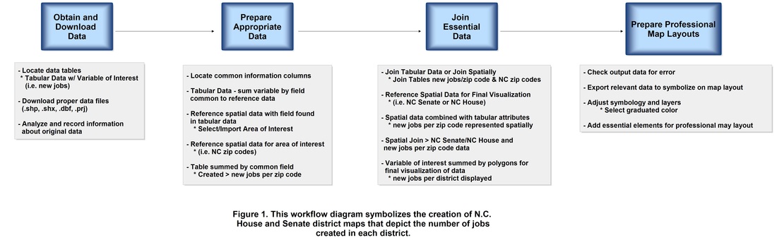
 Figure 1. General workflow diagram for joining tables and performing spatial joins to reach the desired map output. Click on diagram for enlarged image.
Database cardinality refers to the relationship between tables of data. These tables can be tabular information or attribute tables with a spatial association. Connecting or "joining" tabular data to spatial data allows new spatial relationships to be visualized and is an important tool used in GIS. This can be done using several different methods such as ArcGIS, Excel, Microsoft Access, etc. Additional factors must be taken into account when data types are related to each other including field types, attribute similarities and differences, record duplication and errors, relationships and joins, primary keys, etc. The type of relationship is also established and analyzed including 1:1 (one to one), 1:M (one to many), M:1 (many to one) and M:M (many to many).
The problem below identifies the number of jobs created in North Carolina House Districts as well as North Carolina Senate Districts. In an attempt to better solve this problem, ArcGIS/ArcMap was used to analyze and address the study spatially. Based on the data provided, the problem will be approached in various steps. After adding the tabular data and reference files to ArcMap, the industrial extension jobs survey results table will need to be summarized according to appropriate zip code data. The zip code field in the survey results is used to join the jobs data to the reference zip code points. These steps create a spatial reference based on job results. This new layer will then need to be joined with both the Senate and House district layers in order to create a spatial correlation based on a sum of the number of jobs created in each district polygon. These maps will be used to communicate the exact number of new jobs created per district for both the House and Senate Districts.
The problem below identifies the number of jobs created in North Carolina House Districts as well as North Carolina Senate Districts. In an attempt to better solve this problem, ArcGIS/ArcMap was used to analyze and address the study spatially. Based on the data provided, the problem will be approached in various steps. After adding the tabular data and reference files to ArcMap, the industrial extension jobs survey results table will need to be summarized according to appropriate zip code data. The zip code field in the survey results is used to join the jobs data to the reference zip code points. These steps create a spatial reference based on job results. This new layer will then need to be joined with both the Senate and House district layers in order to create a spatial correlation based on a sum of the number of jobs created in each district polygon. These maps will be used to communicate the exact number of new jobs created per district for both the House and Senate Districts.
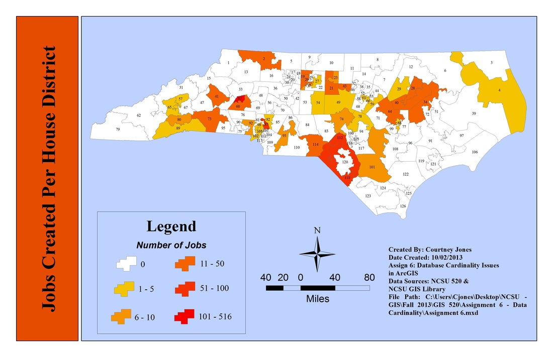
Newly created NC industrial extension jobs by state house district. Click on map for enlarged image.
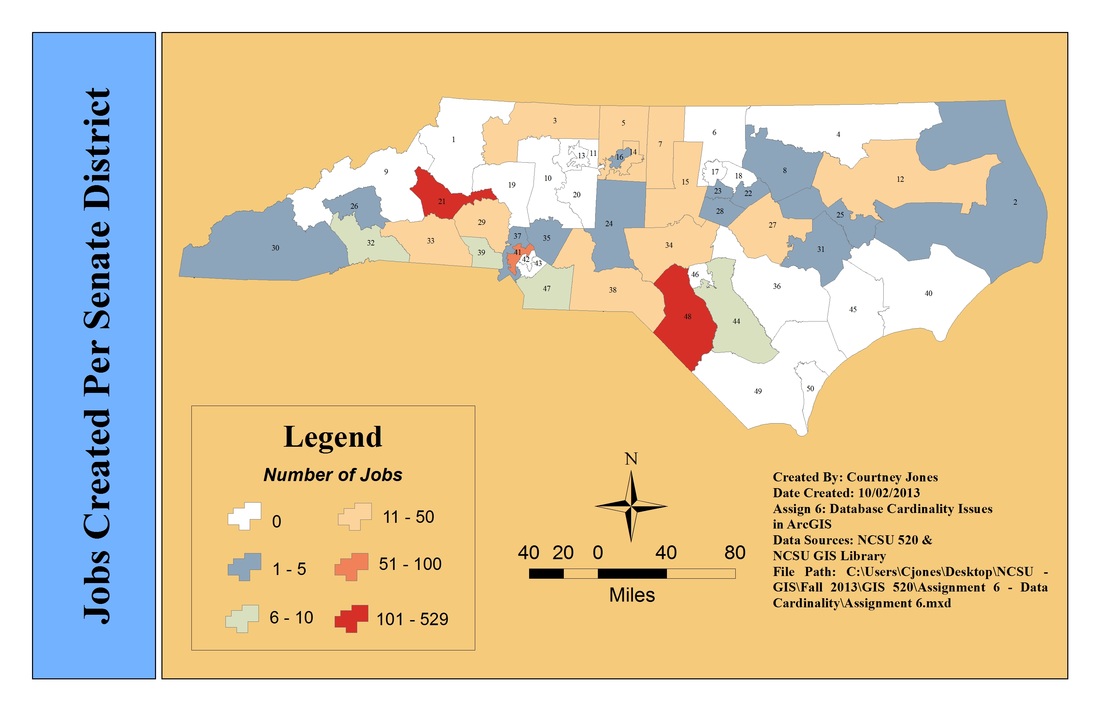
Newly created NC industrial extension jobs by state senate district. Click on map for enlarged image.
The skills and concepts demonstrated in this exercise are likely to be useful when addressing any research question or real-life issue that contains a spatial component. Data cardinality is important when evaluating data collected for a survey, statistics or information that may be recorded in a spreadsheet or database. Databases and spreadsheets often contain a field that could be spatially represented (i.e. N.C. county, area, zip code, district, etc.). If a reference file with the same field exists, it can easily be joined to the data giving the research data a spatial context in ArcMap. These GIS tools will save the state time, money and manpower versus creating the spatial context and analyzing the data by hand.The importance of understanding and applying data cardinality correctly within ArcMap has proven to be an invaluable tool.
